HOUSTON—Throughout time, floods have altered the floodplain landscape. In addition, people have been historically attracted to bodies of water as places for living, industry, commerce and recreation. During early settlements, floodplains provided fertile soils for prime agricultural lands. Settlements emerged along rivers and other waterways for water and food supply, and access to transportation and recreational pursuits.
With population growth came a push to develop into new areas. Due to those prime scenic and navigable locations, some coastal shoreline floodplains were developed for residential communities, commercial and recreational harbors, and tourism enterprises.
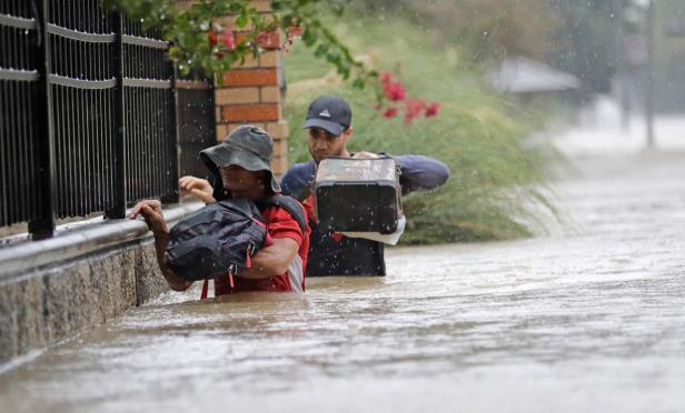
Consequently, development has altered floodplains and the dynamics of flooding in many floodplain communities, resulting in damage and destruction to buildings and community infrastructure by periodic flooding. These areas are continuously shaped by the forces of water either eroded or built up through the deposit of sediment, according to VC Flood Info.
As a result, a substantial portion of the nation's development is now subject to flooding, GlobeSt.com learns. Floodplains account for only 7% of the country's total land, however, this land contains a significant amount of property value. According to estimates provided by the Federal Emergency Management Agency/FEMA, there are 8 to 10 million households in floodplains.
Responsibility for flood loss reduction is shared by all units of government—local, state and federal—and the private sector. Balancing flood risk with expanding population and development continues to be a key challenge for government.
The fundamental floodplain management program is built on the National Flood Insurance Program (NFIP), which provides the maps and regulatory basis for local floodplain management. It is also the primary source of insurance protection for flood-prone properties.
Flood-protection strategies and tools have been developed throughout history:
1800s–The federal government got involved in floodplain management when it had an interest in maintaining the navigability of rivers to facilitate interstate commerce.
1927–The great Mississippi River flood led the federal government to become a major player in flood control.
1928 and 1936–The Flood Control Acts facilitated the role of government agencies to build massive flood control structures to control major rivers, protect coastal areas and prevent flash flooding.
Up until the 1960s–The primary approach to control US floodwater was to use structural flood control projects such as dams, levees and floodwalls. In spite of these efforts, flood losses and flood disaster relief expenses continued to rise primarily because more people continued to build in floodplains.
During the 1960s–Congress became increasingly concerned with the high costs associated with construction of structural projects and federal disaster assistance. It concluded that although federal flood programs were funded by all taxpayers, they primarily helped only residents of floodplains. People continued to build and live in floodplains, and the private insurance industry could not sell affordable flood insurance because only those at high risk would buy it.
1968–Congress passed the National Flood Insurance Act to correct some of the shortcomings of the traditional flood control and flood relief programs. The act created the National Flood Insurance Program and HUD was given the responsibility of administering it. The program distributed floodplain management responsibility to all levels of government and the private sector, established a national standard for regulating development in floodplains by requiring new and substantially improved buildings to be constructed so as to minimize or prevent flood damage, created an insurance program as an alternate for disaster relief which transferred the costs of private property loss from the taxpayers to floodplain property owners through flood insurance premiums, and initiated a floodplain mapping program.
Since the 1970s–Federal, state and local agencies began to develop policies and programs with a non-structural emphasis. That is, ones that did not require projects to physically control or redirect the path of floods but benefited from more environmental approaches such as protection and re-establishment of natural floodplain function, resources and landscapes.
1973–The Flood Disaster Protection Act was passed, which prohibited most types of federal assistance for acquisition or construction of buildings in the floodplains to communities that did not join the NFIP. It required buildings located in identified floodplains to have flood insurance coverage as a condition for receiving federal financial assistance (mortgages, loans) from federally insured or regulated lenders. It also made it a mandatory requirement for communities to join the NFIP in order to receive federal disaster assistance.
1994 –The National Flood Insurance Reform Act established the Community Rating System, increased the maximum amount of flood insurance coverage, strengthened the mandatory purchase requirement, and established a grant program for flood mitigation plans and projects.
Currently–The NFIP is administered by FEMA within the Department of Homeland Security. Many communities no longer depend solely on structural projects to control floodwater. These communities favor multi-purpose solutions that help reduce the risk of flood damage to life and property as well as protect and enhance the natural environment. Examples include regulations to prohibit development in high-hazard areas called the Regulatory Floodway, as well as flood-specific building requirements in floodplains, acquisition of floodplain lands as open space, implementation of flood warning systems, controlling storm water runoff and requiring surface water quality control for development using a variety of environmental techniques.
© 2025 ALM Global, LLC, All Rights Reserved. Request academic re-use from www.copyright.com. All other uses, submit a request to [email protected]. For more information visit Asset & Logo Licensing.


